Weather

Natural Disasters

Experiments
Kid's Zone
Weather Forecasting
How do meteorologists forecast the weather?
Weather forecasting is a prediction of what the weather will be like in an hour, tomorrow, or next week. Weather forecasting involves a combination of computer models, observations, and a knowledge of trends and patterns. By using these methods, reasonable accurate forecasts can be made up to seven days in advance.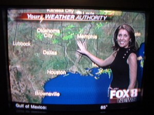
What are weather station symbols?
Weather symbols are used on my weather maps as shorthand for the conditions at weather observing stations.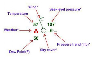
Click Here to see a complete list of all the weather station symbols.
Click Here for an easy print out of the different weather station symbols.
What is a High Pressure System?
A high pressure system is a whirling mass of cool, dry air that generally brings fair weather and light winds. When viewed from above, winds spiral out of a high-pressure center in a clockwise rotation in the Northern Hemisphere. These bring sunny skies. A high pressure system is represented as a big, blue H.
What is a Low Pressure System?
A low pressure system is a whirling mass of warm, moist air that generally brings stormy weather with strong winds. When viewed from above, winds spiral into a low-pressure center in a counterclockwise rotation in the Northern Hemisphere. A low pressure system is represented as a big, red L.
What is a dew point?
The dew point is the temperature at which water starts to condense out of a particular air mass. The dew point temperature changes only when the moisture content of the air changes. The higher the dew point, the greater the moisture content is in the air.
What is humidity?
Humidity is the amount of water vapor in the air.
What is relative humidity?
Relative humidity is the ratio of water vapor contained in the air compared to the maximum amount of moisture that the air can hold at that specific temperature and pressure. Humans are very sensitive to humidity, as the skin relies on the air to get rid of moisture. The process of sweating is your body’s attempt to keep cool and maintain its current temperature. If the air is at 100-percent relative humidity, sweat will not evaporate into the air. As a result, we feel much hotter than the actual temperature when the relative humidity is high. If the relative humidity is low, we can feel much cooler than the actual temperature because our sweat evaporates easily, cooling us off.
What is a weather satellite?
A weather satellite is a type of satellite that is primarily used to monitor the weather and climate of the Earth. Satellites can be either polar orbiting, seeing the same swath of the Earth every 12 hours, or geostationary, hovering over the same spot on Earth by orbiting over the equator while moving at the speed of the Earth’s rotation. These meteorological satellites see more than clouds and cloud systems. City lights, fires, effects of pollution, auroras, sand and dust storms, snow cover, ice mapping, boundaries of ocean currents, energy flows, etc., are other types of environmental information collected using weather satellites.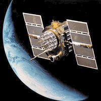
What is radar?
Radar is an electronic instrument, which determines the direction and distance of objects that reflect radio energy back to the radar site. It stands for Radio Detection and Ranging. This is what meteorologists use to see rain or snow.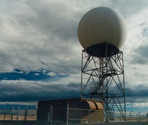
What is Doppler Radar?
Doppler Radar detects precipitation intensity, wind direction and speed, and provides estimates of hail size and rainfall amounts. Doppler Radar gives forecasters the capability of providing early detection of severe thunderstorms that may bring strong damaging winds, large hail, heavy rain, and possibly tornadoes. Combined with satellites, radar gives forecasters the ultimate tools to provide accurate forecasts and advanced severe weather warnings.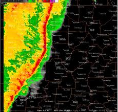
How does Doppler Radar work?
Doppler Radar gets its name from the Doppler Effect. Have you ever listened to a train whistle as it was coming toward you? You probably noticed that the pitch of the whistle changed as the train passed you and moved away. This change in the frequency of sound is called the Doppler Effect. Doppler Radar measures the changes in the frequency of the signal it receives to determine the wind.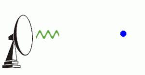
What is NEXRAD Radar?
The National Weather Service has installed a new type of Doppler Radar called NEXRAD Radar. NEXRAD stands for Next Generation Radar. This radar produces many different views of storms and rain that allows meteorologists to determine if a storm could be severe.![]()
Can animals predict weather?
If your dog always comes inside right before it rains, you may think that animals can predict the weather. It’s probably more accurate to say that animals react to certain environmental signals that accompany weather changes, not to the weather itself. A prevalent opinion is that animals can detect certain events, like earthquakes, as soon as they happen, even if the originating event is a great distance away. The majority of researchers say that animals make greater use of their existing five senses, especially when compared to humans. The most critical sense is hearing.
What is an air mass?
An air mass is an extremely large body of air whose properties of temperature and moisture content (humidity), at any given altitude, are fairly similar in any horizontal direction. Air masses can cover large (hundreds of miles) areas. Air masses can control the weather for a relatively long time period: from a period of days, to months. Most weather occurs along the periphery of these air masses at boundaries called fronts. There are 4 general air mass classifications categorized according to the source region: polar, tropical, continental and marine.
1.) Polar latitudes (P) – located poleward of 60 degrees north and south
2.) Tropical latitudes (T) – located within about 25 degrees of the equator
3.) Continental (c) – located over large land masses, dry
4.) Marine (m) – located over the oceans
We can then make combinations of the above to describe various types of air masses.
cP continental polar cold, dry, stable
cT continental tropical hot, dry, stable air aloft, unstable surface air
mP maritime polar cool, moist, and unstable
mT maritime tropical warm, moist, usually unstable
What type of air masses affect the United States?
There are many types of air masses that can affect the U.S., since it is such a large country. Below are a few examples:
cP – wintertime bitter cold can extent to Southern U.S. and even Florida causing crop damage. Require long, clear nights, which means strong radiational cooling of air near the surface. A stable air mass. Little moisture added so air is dry
mP – Winter cP air moves over a region such as the NE Pacific, picking up some warmth and moisture from the warmer ocean. In the case of the Pacific NW mountains force the air to rise (orographic lifting) causing rain.
mT – wintertime source for the SW U.S. is the subtropical East Pacific Ocean. mT air that influences weather east of the Rocky Mountains comes from the Gulf of Mexico, but only influences winter weather in the SE states. Occasionally, slow moving weather systems in SW flow aloft can draw up moisture at mid and low levels producing precipitation.
cT – Continental tropical air usually only influences the U.S. in summertime as warm, dry air is pumped up off of the Mexican Plateau. It is usually fairly stable and dry, and if it becomes stagnant over the Midwest, results in a drought. Deaths associated with the 1995 heat wave in the Midwest were the result of cT and mT air which stagnated over the central and eastern part of the U.S.
What is a front?
A front is a boundary between two different air masses, resulting in stormy weather. A front usually is a line of separation between warm and cold air.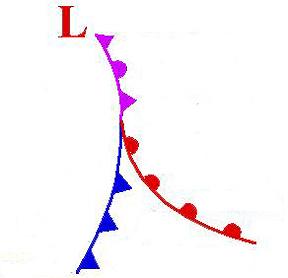
How do you identify a front on a surface weather map or by your own weather observations?
Look for: Sharp temperature changes over a relatively short distance, change in moisture content, rapid shifts in wind direction, pressure changes, clouds and precipitation patterns.
What is a cold front?
A cold front is a boundary between two air masses, one cold and the other warm, moving so that the colder air replaces the warmer air. A cold front is represented as a blue line with the teeth pointing toward the direction on movement.
What is a warm front?
A warm front is a boundary between two air masses, one cool and the other warm, moving so that the warmer air replaces the cooler air. A warm front is represented as a red line with half circles pointing toward the direction on movement.
What is a stationary front?
A stationary front is a boundary between two air masses that more or less doesn’t move, but some stationary fronts can wobble back and forth for several hundred miles a day. A stationary front is represented as an alternating warm and cold front symbol.
What is a occluded front?
An occluded front is a combination of two fronts that form when a cold front catches up and overtakes a warm front. An occluded front is represented as a purple line with teeth and half circles.
What is a trough?
A trough on a weather map is an elongated area of relatively low pressure. Troughs bring cloudy and rainy weather. A trough is represented by a hash mark line.![]()
Lesson Plan: Here is a great lesson plan on learning how to forecast. In this activity, kids learn about different forecasting tricks.
Lesson Plan: Here is a great lesson plan on weather symbols for younger kids. This lesson plan requires kids to match the weather symbols to words. You will need to download this file to then be able to print off copies for your students.
The Doppler Effect Experiment: Here is a an experiment that teaches kids what the Doppler Effect is. They can learn how the Doppler Effect works and why Doppler Radar is such an important tool in weather forecasting.
Suck An Egg Into A Bottle Experiment: Here is an experiment that shows how pressure is created in our atmosphere by sucking an egg in a bottle. This is a very cool experiment!
Make Your Own Barometer I Experiment: Here is an experiment that allows the kids to make a barometer.
Make Your Own Barometer II Experiment: Here is an experiment that allows the kids to make a barometer.
Make A Rain Gauge Experiment: Here is an experiment that allows a kids to make their very own rain gauge.
Water Cycle Experiment: Here is an experiment that teaches kids about our water cycle. This experiment shows what happens to the water in our creeks, streams, rivers, lakes and oceans.
Make A Thermometer Experiment: Here is a great experiment that allows the kids to make a thermometer.
Make An Anemometer Experiment: Here is another great experiment that lets kids make an anemometer or wind vane.
Make A Windsock Experiment: Here is an experiment that allows the kids to make a windsock.
Science Fair Project Ideas: Here is a complete list of science fair project ideas. Discover the science behind the weather that impacts us every day.
